

with Yonatan Cohen
2013
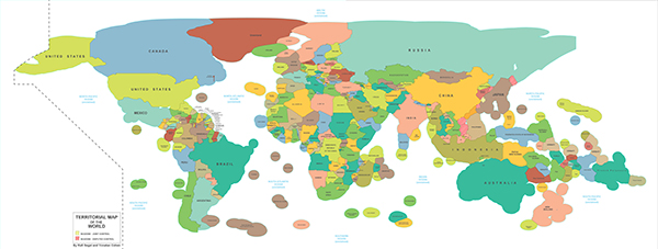
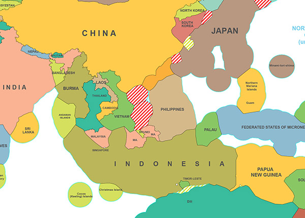
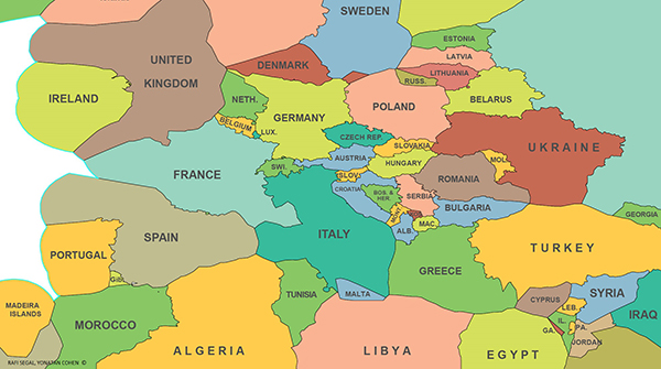
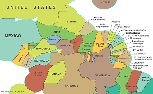
This political map of the world depicts the extent of territories, both on land and at sea (submerged lands), which are under the control of all independent nations. The map incorporates Exclusive Economic Zones (EEZ), which are sea zones whose resources belong to their coastal-lying nations. International law defines these zones as lying within a 200 nautical miles geometrical offsetting of the coast seawards, and, where these geometrical boundaries prove ambiguous, through international treaties.
Throughout the development of sea voyage and charting technology, coastlines, historically mapped as linear entities dividing land from water, became one of the first geographical features to be accurately represented in maps, thus becoming a common datum for exploration. However, the past century has brought a profound change in the way we understand and measure the world. The rudimentary divide of water and land, a cultural and psychological divide as well as an obsolete mapping artifact, has become irrelevant both to current political and economic concepts of space, and in light of more recent national sovereign claims over sea zones. Today, we envision the world to a greater extent as a continuous space where the movement of people and information overrides geographical and political barriers. Furthermore, technological advancements have enabled us to approach the waters as a territory of potentialities: for the production of wild and cultivated food; for mineral extractions, natural gas and fossil fuels; and for the future harvesting of energy.
This new map of the world’s division of resources can as well be viewed as a division of environmental responsibilities. The exponential increase in maritime activity and water pollution demands more control and supervision over the use of sea zones. In support of our shared goal for a well-maintained planet, this map can become a tool for negotiating the boundaries of our sustainable seas.